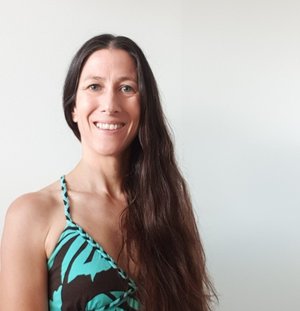
When Pauline Weatherall, data scientist at the National Oceanography Centre’s British Oceanographic Data Centre, first heard she had been awarded Member of the Order of the British Empire (MBE) for services to bathymetry, she thought it was a scam. “We’ve had postal strikes in the UK, so they sent an email via my work email address. I thought it was spam.”
The award was, of course, genuine. Weatherall, who is also a member of Seabed 2030’s Global Center and the General Bathymetric Chart of the Ocean (GEBCO) Digital Atlas Manager, is an internationally recognised expert in bathymetric data. She has contributed to several scientific papers and international reports with organisations, including the Intergovernmental Oceanographic Commission of the United Nations Educational, Scientific and Cultural Organization. “I feel very honoured to be receiving [the award],” Weatherall says, “but it’s also a recognition of all the work that everybody does for GEBCO and Seabed 2030.”
An evolution of seabed mapping
With a career spanning some 32 years, Weatherall has seen many changes in the world of seabed mapping. “When I started [at the British Oceanographic Data Centre], GEBCO was moving from paper charts to the digital world. My job was to check the digitised bathymetric contours that went into the first GEBCO Digital Atlas,” says Weatherall. Although GEBCO’s data sets are now available online in the form of a global bathymetric grid (the GEBCO Grid), their first incarnation existed on CD-ROMS. “This was before Google Earth and anything like that. It was all very high-tech at the time.”
Advances in technology haven’t just changed how people interact with the GEBCO Grid. It’s changed the quality and quantity of the underlying data used to produce the product. Most notably, today, we can map more of the seafloor in greater detail than we could one hundred, fifty, or even twenty years ago. At Seabed 2030, “we’ve been doing some work with historical GEBCO charts going back to 1903, and it’s quite interesting to see the progression in detail,” says Weatherall, explaining how the depiction of features such as the Mid-Atlantic Ridge on maps has changed as more bathymetry data has become available. “It’s like putting my glasses on, and all of a sudden, there’s the detail, the seamounts and trenches, etc., that you haven’t seen before.”
A collaborative community
Technology plays a crucial role in collecting, processing, visualising, and making seabed data readily available, but for Weatherall, there is another factor that is just as important. Collaboration.
Weatherall highlights the collaboration between the Nippon Foundation and GEBCO, which resulted in the Seabed 2030 project as something that “supercharged the mapping of the global seafloor.” Alongside working closely with colleagues at the British Oceanographic Data Centre, such as Dr Helen Snaith, head of the Global Data Center and Dr Chris Thompson, IT development, Weatherall also works closely with colleagues at Seabed 2030’s regional centers.
“Seabed 2030 has dedicated staff at regional centers who ferret out data that exists that we don’t have a hold of and encourage the community to contribute data,” Weatherall explains. The regional centers also prepare much of the underlying data that feeds into the Digital Atlas. Regional centers send their data to Weatherall as a grid, representing the bathymetry in their particular region. “I check to make sure there aren’t any errors in the grids and give feedback if something doesn’t look quite right,” Weatherall says. “We also get valuable input from GEBCO colleagues to help with the grid review process.” Once the review is complete, “we then make the final grid from the corrected data.”
Alongside the regional Seabed 2030 centers, Weatherall also works with David Sandwell and colleagues at the Scripps Institution of Oceanography. “They produce a bathymetric grid, SRTM15_plus, which is created from measured data and interpolation guided by satellite-derived gravity data. We use this as a ‘base’ for the GEBCO grid – for areas where we do not have measured bathymetry data.” Weatherall explains. “We provide feedback on their product and merge the regional grids on top of this base grid.”
The Digital Atlas evolution continues
The Seabed 2030 project aims to map the ocean floor at the best possible resolution within practical limits. The 2022 release of the GEBCO grid shows some 23% of the global ocean mapped to the criteria defined by Seabed 2030. Weatherall hopes to see more data shared with Seabed 2030 to bring that figure to 100%. Data sharing is “happening more and more, but [getting data] is one of the challenges,” says Weatherall. “We need data that is archived and not yet available, and we also need to collect more data,” Weatherall adds, highlighting the potential role of the International Hydrography Organization’s crowdsourced bathymetry initiative in contributing data
As for the GEBCO Grid itself, Weatherall says they are working on making variable-resolution grids available. “At the moment, the GEBCO product is just one resolution. Sometimes people ask if higher resolution exists in a particular area, and it does. It would be really useful for people to have access to the different resolution grids.”
“There are always challenges, and there are always new things that you’re doing,” says Weatherall. “The people I work with and the international community are all very supportive of each other. It’s a really nice and interesting project to be involved in.”
This story was written for Seabed 2030