Training for a collaborative mapping future
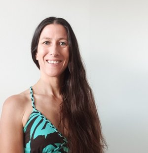
Since the launch of the Nippon Foundation-GEBCO Seabed 2030 project in 2017, the pace of seabed mapping has stepped up. Starting with just six percent of the ocean floor mapped to an adequate resolution, that figure stands at around 25 percent and is only set to grow today. “What Seabed 2030 has managed to achieve is remarkable,” says Dr Rochelle Wigley, project director for the Nippon Foundation/GEBCO Training Program in Ocean Mapping.
For Wigley, Seabed 2030 is just as much about the people as it is about the mapping. “We are taking a collaborative approach to science, and it really is everyone working together that is going to make a difference and allow us to reach our goals,” says Wigley. That collaboration isn’t just about receiving data to add to GEBCO’s range of bathymetric datasets and products. It’s also about building capacity.
Training the next generation of seabed mappers
During the late 1990s and early 2000s, it became apparent that there was a seabed mapping skills shortage. This problem was – and remains – particularly acute for developing nations. “The people working in ocean mapping were ageing, and there was an imbalance [in capacity] between developed and developing nations,” Wigley explains. What’s more, outside of naval training, the options for people to train in seabed mapping were few.
The solution came in 2004 with the Nippon Foundation/GEBCO Postgraduate Certificate in Ocean Bathymetry training program. Held at the Center for Coastal and Ocean Mapping/Joint Hydrographic Center, University of New Hampshire, and with the ongoing involvement and support provided through the Nippon Foundation’s Scholarships and Fellowships for Global Ocean Issues initiative, the program has trained 118 people from over 46, primarily developing, nations. “We intentionally chose to make it a graduate certificate and not a master’s program because it allows us to bring in a much more diverse group of people into the training,” says Wigley. [The students] come from different backgrounds and cultures, different languages, different education, different sectors…that diversity has helped the students learn from each other and fosters collaboration.”
The latest cohort will start their training in late August. During the twelve-month program, they will have classroom-based courses, such as Integrated Seabed Mapping Systems, Advanced Topics in Ocean Mapping, Geodesy and Positioning for Ocean Mapping, as well as training in the field. Students will also undertake a working visit to a research organisation or take part in a research cruise during the summer. Here, the students can solidify their learning and gain real-world experiences. Crucially, it is also a mechanism for them to expand their network.
Building a network
“For us at GEBCO and for the Nippon Foundation, one of the most important things to come out of this training program is the network of people. Scientists, industry, naval, it improves everyone’s ability to map the ocean,” says Wigley. Alongside the working visit, the student cohort itself can discuss the commonalities and differences in their own experiences, the challenges their home nations face, and more. Those instructing the students include people from the university, the private sector, and government agencies, exposing students to different knowledge and perspectives on seabed mapping.
Once students have completed their training, the graduates typically return to their home nation, where they can apply their knowledge to mapping the seabed and help build local capacity. The graduates also become part of the Alumni Network, enabling them to continue to foster their relationship with the seabed mapping community and make valuable contributions to global seabed mapping efforts. Within Seabed 2030, “we have alumni on the strategic advisory board, in the regional data centres, in working groups,” says Wigley. “Having this global diversity is really important for finding solutions, building capacity, and driving seabed mapping projects forward that might not happen otherwise.”
One project that has come out of the Alumni Network that Wigley is particularly proud of is when the Alumni team won the 2019 Shell Ocean Discovery XPRIZE challenge with a solution that included an uncrewed surface vehicle that could deploy and recover an autonomous underwater vehicle, with both capable of mapping the seabed at different resolutions. The Team also worked closely with industry partners to ensure a data-to-information pipeline that ensured that the collected data could be easily accessible globally.
Another project to arise from the Alumni Network is the non-profit organisation Map the Gaps. “It’s about connecting a diverse group of people who can contribute to mapping the ocean,” says Wigley. Map the Gaps hosts the annual Map the Gaps Symposium and has been involved in several seabed mapping projects. One example comes from a collaboration with Victor Vescovo, a deep-sea explorer who owned the DSSV Pressure Drop.
“[Vescovo recognised that while he was taking his vessel from trench to trench, he was covering large areas of unmapped ocean, but they were not mapping. He worked with the Center of Coastal and Ocean Mapping and then with Map the Gaps to get Alumni on board the DSSV Pressure Drop to do mapping during transits and dive legs,” Wigley explains. “These types of projects help the Alumni stay active and involved in the wider ocean mapping community, as well as contribute both knowledge and financially to their local communities.”
Wigley says that she believes that the success of the training program can be measured by the individual successes of each alum. “They have all gone home with a passion for ocean mapping that is reflected in so many ways, whether in their career development, further education or involvement in GEBCO and/or Map the Gaps projects. This growing network of individual successes will play an important role in helping us map our oceans.”
This story was written for Seabed 2030